Beautiful Ash Cave to Cedar Falls Trail in the Hocking Hills
The Ash Cave to Cedar Falls trail in the Hocking Hills is a must for any waterfall-loving hiker. It begins and ends at Ash Cave in an out and back hike to Cedar Falls via the Buckeye Trail. About 5 miles round-trip, this is the ideal hike for someone looking for a longer, more serene route to see two of Hocking Hills State Park’s most popular waterfalls. Oh, and the Ash Cave Fire Tower on the way. Let’s dive in to your complete guide to this lesser known trail.

This post may contain affiliate links. As an Amazon Associate I earn from qualifying purchases.
Trail Features: One Serene Hike, Two Waterfalls
- Out and Back Hike: This hike is an out and back hike, meaning hikers will travel one-way on a trail from Ash Cave to Cedar Falls, turn around at Cedar Falls and return to Ash Cave on the same trail.
- 5 Miles Round-Trip: From the parking lot at Ash Cave to Ash Cave is .25 miles (1/4th of a mile) to the large recess cave and waterfall. From Ash Cave to Cedar Falls is about 2.3 miles. Hiking from Ash Cave to Cedar Falls and back totals about 5 miles round-trip.
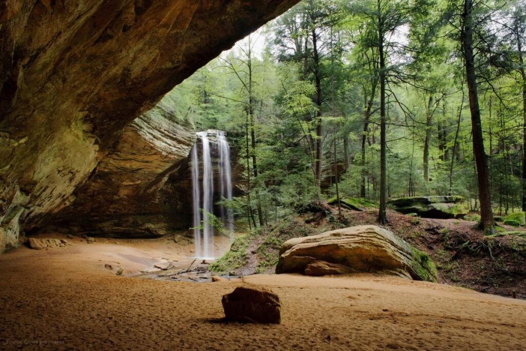
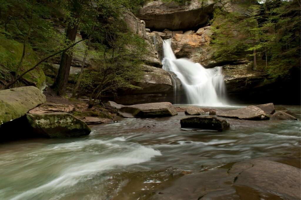
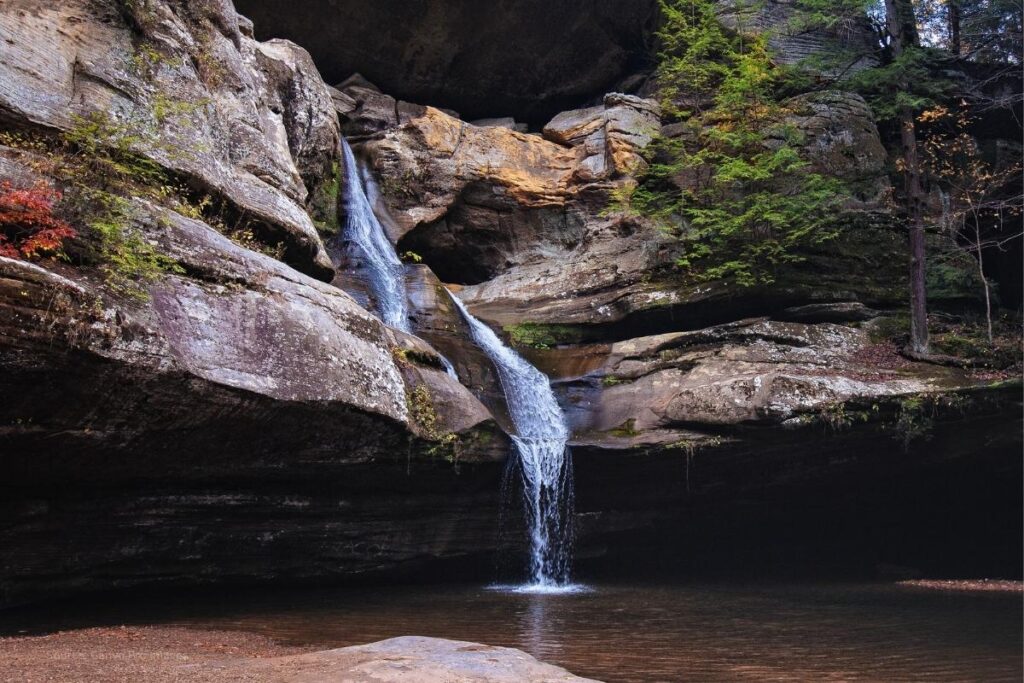
- Two Waterfalls: You will see TWO keystone waterfalls of the Hocking Hills on this hike: Ash Cave and Cedar Falls. These are some of the Hocking Hills State Park’s most popular waterfalls, accessed by a less-traveled trail.
- Ash Cave Fire Tower: On the way from Ash Cave to Cedar Falls you’ll pass the 80-foot tall Hocking State Forest fire tower. This tower was used in the past for surveillance of wildfires in the state forest. Visitors can climb the stairs of the tower at their own risk when weather conditions allow. You’ll get a 360-degree view of the beautiful Hocking Hills from the top!
How to Hike From Ash Cave to Cedar Falls
This trail is a portion of the Grandma Gatewood Trail/Buckeye Trail. Beginning at the Ash Cave parking lot and following the Grandma Gatewood Trail/Buckeye Trail will take you to Cedar Falls. Turn around and follow the same trail back to Ash Cave.
BEGIN: Park at Ash Cave. Cross the road to begin at the Ash Cave trailhead.
- ASH CAVE ADDRESS: 27291 State Route 56, South Bloomingville, OH 43152
- ASH CAVE GPS COORDINATES: 39.3996 N, 82.5444 W

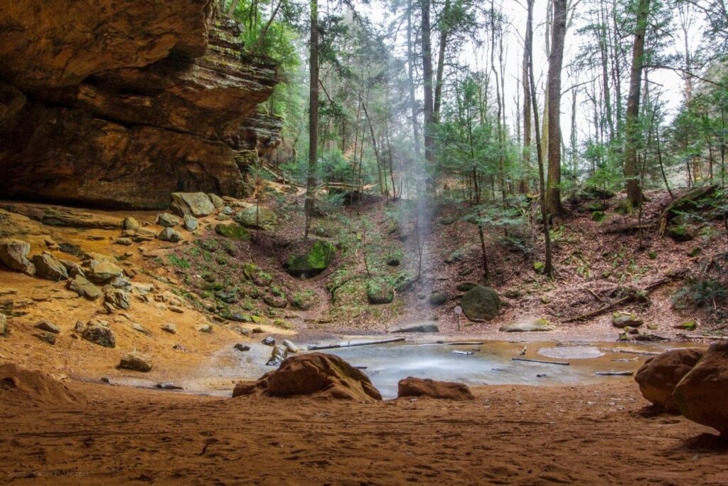
Hike from the parking lot along the one-way paved path to Ash Cave. Go through the cave and up some stairs until a fork in the trail. Go left at the fork to hike to Cedar Falls. After hiking about a mile, you will pass the Ash Cave Fire Tower where you can climb to the top for a birds-eye view of Hocking Hills!
Continue on the trail to Cedar Falls. This trail is MODERATE DIFFICULTY on uneven forest ground on a dirt trail and old forestry service road.
DESTINATION: You will arrive at Cedar Falls as your destination on this hike since it is an out and back hike.
- CEDAR FALLS ADDRESS: 21724 State Route 374, Logan, OH 43138
- CEDAR FALLS GPS COORDINATES: 39.4195° N, 82.5235° W
At Cedar Falls, cross the parking lot roadway and continue to the entrance. Follow the signs to hike down to Cedar Falls. Once you’ve enjoyed the beautiful falls, turn around and return on the same path to Ash Cave.
END: Since this is an out and back hike, you will end where you began–Ash Cave.
- ASH CAVE ADDRESS: 27291 State Route 56, South Bloomingville, OH 43152
- ASH CAVE GPS COORDINATES: 39.3996 N, 82.5444 W
Remember the fork in the trail at Ash Cave where you went left to go the Cedar Falls? When you reach that fork again on the way back, continue straight on the foot trail leading around the rim of Ash Cave. This trail is the Ash Cave Rim Trail and will lead you right back to the trailhead and parking lot.
Ash Cave to Cedar Falls Trail Map
Below the trail map image you will see a “Download Trail Map Here” button. Click on the button and it will open a Google Drive file to download and print the 8×10 PDF.
Ash Cave to Cedar Falls Trail Map Free PDF Download

Frequently Asked Questions About the Ash Cave to Cedar Falls Trail
It’s about 5 miles round-trip as an out and back hike. It’s .25 miles into Ash Cave and then about 2.3 miles from Ash Cave to Cedar Falls.
View and print your Ash Cave to Cedar Falls trail map HERE.
Or to view and print the entire Hocking Hills State Park Trails map, click HERE.
To begin the Ash Cave to Cedar Falls trail, you will park at the Ash Cave parking lot located at 27291 State Route 56, South Bloomingville, OH 43152.
The Ash Cave trail is .25 miles (1/4th of a mile) one-way. To hike it round-trip is .5 miles (1/2 of a mile).
Ash Cave to Cedar Falls is about 2.3 miles one-way when following the Grandma Gatewood Trail/Buckeye Trail.
Yes, as in all Ohio State Parks and forests, dogs are allowed on this trail but must be on a leash. Read here about the best dog-friendly trails in the Hocking Hills.
Make the Most of Your Hike
The Ash Cave to Cedar Falls hike is ideal for anyone looking for a longer, less-traveled hike to see these popular destinations. This is also a dog-friendly trail as on-leash dogs are welcome in Ohio state parks and forests so be sure to bring your pup along! Check out my post Best Trails for Dogs in the Hocking Hills for more trails to explore with your dog.
As always, remember to exercise sound judgment and common courtesy on the trail. Stay on the trail to protect wildlife and delicate habitats. Wear sturdy shoes, and bring plenty of water and snacks. Enjoy the serene and beautiful surroundings as you explore the Hocking Hills!
If you’re looking for more information on a shorter, easy hike great for beginners, check out my post Easy Hiking Trail in the Hocking Hills: Ash Cave.
If you’ve hiked from Ash Cave to Cedar Falls, share your experience by leaving me a comment telling me what features you enjoyed. Share this post with someone who would enjoy this lesser-known, serene hike.
See you out there!
Pin to save for later!